Arwen's meanderings

Hi everyone and welcome to my dinghy cruising blog about my John Welsford designed 'navigator' named Arwen. Built over three years, Arwen was launched in August 2007. She is a standing lug yawl 14' 6" in length. This blog records our dinghy cruising voyages together around the coastal waters of SW England.
Arwen has an associated YouTube channel so visit www.YouTube.com/c/plymouthwelshboy to find our most recent cruises and click subscribe.
On this blog you will find posts about dinghy cruising locations, accounts of our voyages, maintenance tips and 'How to's' ranging from rigging standing lug sails and building galley boxes to using 'anchor buddies' and creating 'pilotage notes'. I hope you find something that inspires you to get out on the water in your boat. Drop us a comment and happy sailing.
Steve and Arwen

Monday 31 May 2010

My first passage plan......let's hope it works!

Well here we go - my first passage plan......this could be interesting.

I intend sailing this Wednesday June 2nd. I'll leave Queen Anne's battery and motor out to South Mallard buoy for 10.30am departure. 


Where I always launch from - the southern slip (on the left!) at QAB
The big glass building on the right is the National Marine Aquarium
In the background is the famous Barbican

I'll head out past the west end of the breakwater up to the Knap buoy before swinging east towards West Tinker buoy. Then I'll head north to the eastern end of the breakwater, up to the Duke buoy and back to where I started at South Mallard. Its 6 NM.


The western end of the Plymouth Breakwater copyright Michel LaLonde

The weather is predicted Force 2/3, from north west...sunny with odd cloud and temp around 19 Celsius. Visibility is good and sea state slight.


Wednesday's weather forecast: source BBC/Met Office

I should be on a beam reach/training run for the outward leg; from Knap to West Tinker it should be a downwind run before turning onto a close haul run back to port........I think......if my visualisation is right!  Now whether this is the right way around to do this route.......or not...... I have no idea. If anyone knows better.......please let me know before Wednesday!


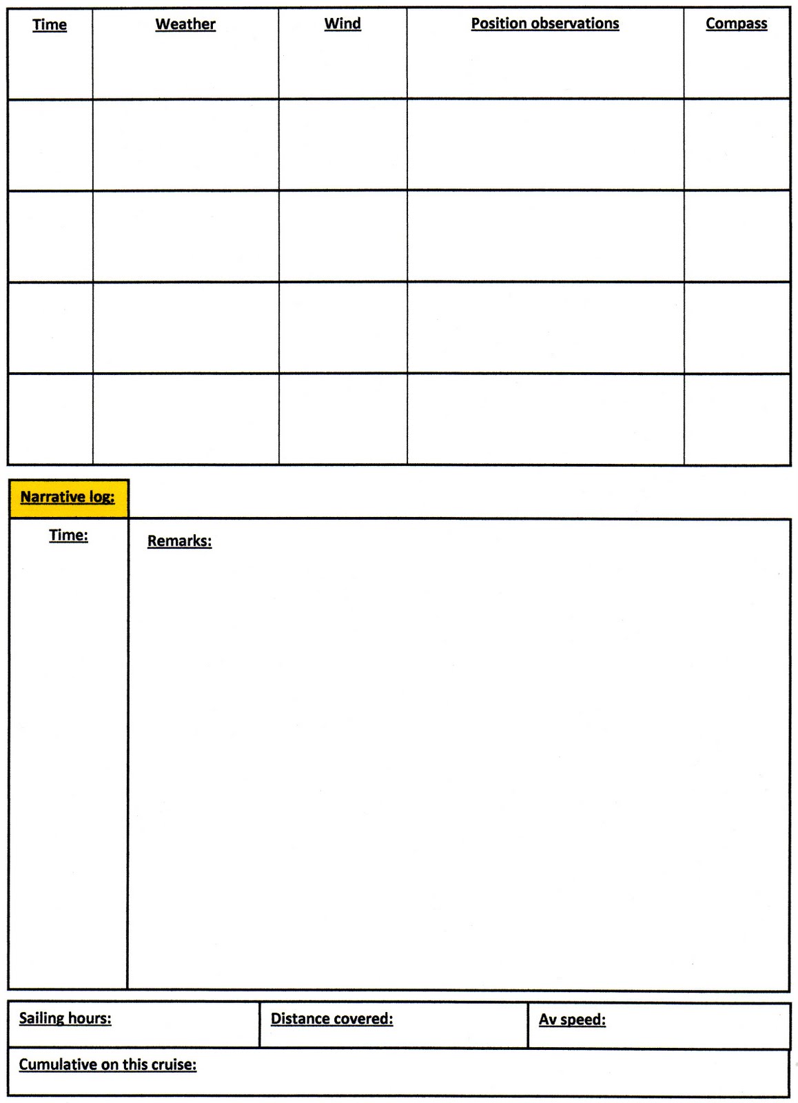
My passage plan template
I combined two or three to get what I wanted

High tide is at 9.45am - 4.9m falling to 1.7m at low tide (so the tidal range is 3.2m if my maths is correct....and that's a BIG if!). It's an outgoing tide, with low tide at 16.04. The tidal stream according to the tidal diamonds is negligible for first two hours on outgoing tide. However, on the close haul from east breakwater back up to Mounbatten - there is a 1 kt tidal stream running 171 degreeM - so against me - so that will affect my progress northwards. I think I will be averaging 3 knts so on this leg I'll drop to 2 knts.


I managed to work out how to use them - brill!

Dead reckoning suggests I should do 6NM at 3 kts in 2hrs. So my ETA back at South Mallard should be around 12.30pm.  However, when I take into account the tidal stream then it will be around 12.45 ish.

I've marked the route on the chart using the conventional symbols; I've also worked out the magnetic bearing, distance and dead reckoning time between each buoy. I've entered them as waypoints in my GPS and I've created a route ready for Wednesday. I'm slightly panicky that I've got my latitude and longitude reading off the chart scales wrong. I'm OK at say N50d 20'....its then getting the end bit right......um!


A page from my Admiralty Tough Chart showing Plymouth Sound north of Breakwater
Area 13: Plymouth Sound and rivers     1st edition SC 5913
Published by Admiralty Leisure

I printed off a passage plan and sealed it into a clear plastic wallet which I can now write over the top of in chinagraph pencil - a perfect re-useable passage plan framework.  I've also taken the precaution of sketching out annotated diagrams on how to pick up moorings/leave moorings under sail etc and I've taped them into another clear plastic wallet.


The reverse side of my passage plan

I now feel ready! I'll check the forecast again tomorrow; and go over the calculations again. Of course.....I'm stuffed if I average 4 or 5 kts....I'll have to redo the maths on the go........never a good thing given my non maths ability!  So I've taken the liberty of copying the ready reckoner from that book I recommended on a previous post.....


from Sea Kayak Navigation by Franco Ferrerro....see a previoug for further details
Of course if you do above 4 knots......you'll have to work one out for youself!

Steve

Saturday 29 May 2010

My wonderful Plymouth Sound


The weather is lousy here, constant drizzly rain, squally winds and variable temperatures. The tides are awkward as well with big spring high tides around 9.00am. What with weddings and work and birthday parties - the number of sailing days available is diminishing fast!

Someone emailed me to ask about my home sailing area of Plymouth Sound....so here we go a little background.

Plymouth Sound......when I stood on the Hoe for the first time....I fell in love with the place and knew instantly I’d live there for the rest of my life. I was 18, I’d just gone to visit the college (which I also loved) and I had spare time before my train back to South Wales. I walked through the city centre and up onto the Hoe..........and that spectacular view emerged. Wow! Sadly after leaving college, the only jobs were in south east England and so I had to spend eight years living in Surrey...........but I got back to Plymouth eventually and have never wanted to leave the place since.


Looking out over Drakes Island in Plymouth Sound
from Mt. Edgecumbe Country Park in Cornwall

Plymouth Sound is at 50.343°N, 4.143°W. It is the most amazing bay with Penlee point, (a coastal headland with a medieval chapel, old gun battery and a nature reserve) at its south east corner; and Wembury point (and the Great Mewstone island) to the south west. From a line across those two points, Plymouth Hoe is about 3.2 nautical miles north. It’s a huge open space above some limestone cliffs at the foot of which is the famous tinside pool – a 1930’s lido complex which has been recently restored.


The Tinside Lido, very popular in Summer
Found right at the foot of Plymouth Hoe

Hoe is an Anglo Saxon word meaning sloping ridge shaped like a foot and heel (can’t quite see that myself but I’ll take our Anglo Saxon’s forefathers word for that). It is part of what makes Plymouth so special – a long time ago they carved outline images of the giants Gog and Magog into the turf on the Hoe (a Cornish folk lore); Sir Francis Drake played bowls there in 1588 before sailing out to help destroy the Spanish armada; the huge stone citadel (now a Royal marine base) was built there in the late 1660’s to protect the port of Sutton and to intimidate the townsfolk who were leaning towards Parliament in the English Civil War.......the scoundrels!

Marauding pirate or English folk hero -
the one and only Sir Francis Drake


There was a pier as well at the foot of the Hoe...........German bombers got it....along with much of the city centre ......which was why it was redeveloped by Abercrombie!

Along the top of the Hoe is a huge tarmac promenade..........we have military tattoos up there; the British fireworks championship over at Mountbatten is watched by hundreds of thousands, from this area; it hosts fairs, Royal Navy days; I’ve watched transatlantic races start and waved to returning Fastnet Race boats. Then there is the iconic image of Plymouth around the world – Smeaton’s tower. It’s the upper part of one of the first Eddystone lighthouses......dismantled in 1877 and moved stone by stone to the Hoe to be re-assembled.


The iconic Smeaton's tower on Plymouth Hoe


One of my special places is the war memorial. The large one commemorates the Royal Navy dead from both World wars.......there was outrage throughout the city a few years ago when dishonorable people stole the bronze plaques listing the names of our fallen........the Devon and Cornwall Police did a marvelous job of tracking down the thieves.....and found all the plaques – some had been cut up ready for melting down but they’ve been restored.


The War Memorial and view from the Hoe across to Drake's Island

Two nautical miles out is the famous Plymouth breakwater. It is midway between Bovisand fort and Cawsand Bay in Cornwall. 1600m long, 13m wide at the top; 65m wide at the base and 14m deep - it was built in 1812 and was designed to provide a safe harbour for sheltering Royal navy ships from prevailing south-west storms. It’s got 4.5 million tonnes of rock in it..........for those of you who I knew wanted to know.........!


You can fish from here in the summer
if you can persuade local charter boats to drop you off........
and if the remember to collect you at the end!

Just behind it is the round breakwater fort – somewhat dilapidated I’m afraid. It originates from the 1860 Lord Palmerstone plan for the defence of Plymouth....the aim was to defend the entrances to the sound harbour. It was an anti aircraft gun training centre during WW2. I have no idea who owns it now or what it is used for. On the Cornish side is another fort – Fort Picklecombe – again commissioned for the defence of Plymouth – now it’s been converted into apartments!


Fort Picklecombe gurading the western entrance to Plymouth Sound

No so far out from the Hoe....is Drake’s island. It has a fort to protect the deepwater channel into Devonport dockyards, up the River Tamar. Stretching out to the west are the anti submarine traps........a real place to avoid trust me! There was a chapel put here in 1135; Drake sailed from here in the early 1500’s to circumnavigate the world; it was fortified as a barracks in case of Spanish or French attack (we really were paranoid along the south coast weren’t we!) Since then, its been owned by the city council; turned into and outdoor education centre and then bought by a former owner of Plymouth Argyle football club who has plans to turn it into a hotel. Talking of Drake – he crops up everywhere...we British regard him as a masterful explorer and hero. Of course, if you are Spanish, then you will have a different view.....a marauding unscrupulous pirate! He was a marauding, looting and pillaging thug if the truth were but known...but hey we like him!


Drake's Island......the pier faces north towards Plymouth Hoe

On the north east corner of Plymouth sound is the Cattedown – the estuary of the river Plym. It is protected by the Mountbatten breakwater. In Mountbatten are the former aircraft hangers which housed the RAF flying boat squadron during WW2. Actually, TE Lawrence was based there as were the RAAF squadron 461 who manned the flying boats. These were Sunderland’s – flying boat bombers whose primary aim was to search out and destroy the dreaded U boats. They flew anti submarine patrols over the Bay of Biscay and by the end of the war they’d accounted for 6 U boats. The RAF left the area in 1985 or 86........they had had a search and rescue centre there. Now it’s a water sports centre with fantastic staff and courses. The hangers are owned by the Bridgend boat building company I think.

 
One of the Flying sunderland's entering the Cattedown with the Citadel in the background

And there we are....a whistle stop tour of my home waters......there is never a dull moment in Plymouth Sound......and one day I will tell you how I nearly parked Arwen on top of an incoming nuclear sub! To say that the Royal Navy Police inflatable boat team were dripping with sarcasm........would be a serious understatement bless ‘em. Actually they were really funny and really nice about the whole affair.......but it’s a story for another time!

Steve


Thursday 27 May 2010

Passage planning: teaching myself.......or not as the case may be!

I’m an educationalist. Rumour has it I know a thing or two about teaching, learning and education. Well, I’d forgotten how hard it is to learn something completely new when you have few previous experiences to draw upon. Take passage planning, for example. I’m teaching it myself. I expect many will say...”so what, no problem, basic common sense”.........well maybe......but remembering it all; having a systematic approach on going about it.......that takes time to internalise doesn’t it?


I’ve found three really useful books – I’m sure there are many more....but these I like.

The first is Sea kayak navigation by Franco Ferrero (published by PESDA PRESS ISBN: 9781906095031).


I like its simple style, informative diagrams and simple end of chapter tasks that help you practice what you’ve just read.

Another one I like and have found easy to understand is Inshore Navigation by Tom Cunliffe Wiley (Nautical Press ISBN 9780470753897). It’s informative, with a nice writing style and good illustrations.


Finally the third one is a useful reference book REED’s Skipper’s Handbook for sail and power (Adlard Cole Nautical ISBN: 9780713683387). It’s just a simple mine of information for when you’ve forgotten what you’ve just learned.


So where am I now on my massive learning journey?


Well I’m about to plan my first passage plan proper for going up the Lynher which I will attempt sometime over the next few weeks. Basic things I’m learning/grappling with:

1. Using the coastline as a handrail; applying what I know about using OS maps – checking off prominent landmarks; orientate the map/chart to follow the coastline as I go along

2. Knowing my chart symbols and get really familiar with them and checking them off as I sail along

3. Getting distance measurements right – I’m having to grapple with new co-ordinate work (lat and long) and nautical miles not kilometres. 1 nautical mile = around 2 km; it’s slightly more than 1 land mile and 1 knot = 1 nautical mile....duh! Then 1 minute of latitude = 1 nautical mile, so 1 degree of lat = 60 nautical miles. Brain is beginning to ache – feeling a Homer Simpson moment approaching - doh!

4. Remembering to measure distance on the chart off the side latitude scale and because of the way charts are drawn – measuring distance using the scale opposite to the point where you are measuring.....ah!

A page from my admiralty tough charts
A brilliant waterproof chart suitable for open boats

5. Carrying an OS map as well as the chart – you never know when you may decide to beach and explore......something else to add to Arwen’s equipment list

6. Doing as much chart and planning work as you can at home before you go e.g. tide calculations, chart corrections etc. Steve Earley with his Log of Spartina, has always impressed me and been my role model (he may not know that!) with his thorough approach, even to downloading aerial photographs of his passages......I like that thinking

7. Carrying chart work equipment in the boat in case you have to change plans; having a waterproof notebook. I’ve stuck white sticky back plastic onto my box lid (in the box is binoculars, chart stuff; sunnies; etc – stuff I need immediate access to). The lid forms a good work platform and chinagraph pencil rubs off sticky back plastic with no problem – I got that tip from the Kayaking navigation book!


8. A tip I picked up from one book was to draw extra lat and long lines on the chart (I use admiralty tough charts – A3 and waterproof). It helps enormously.


9. I’ve got in my head all about tides, their formation and tide types – semi diurnal etc – useful to know and I’m pretty familiar with using tide tables to get tide times and heights as I did lots of fishing until work took over my life...as it does!


10. Tidal streams – beginning to get to grips with.....I think. Tides are a nightmare for me – I learned to sail in the Med – little tide.........coming alongside pontoons, picking up buoys......terrifying when you have to try and work out which is stronger......so many permutations and never been shown any tactics or what to do ......insane! There are lots of new things I didn’t know – I never realised that you can assume, safely that the speed of tidal streams is half as fast at neaps as it is at springs – makes sense...but I’d never thought about it before. I hadn’t really twigged that tidal streams inshore will follow the coastline.....I knew it because it affects fishing but I’d never thought about it before. There was a nice tip in one book about cutting out tidal stream maps for your area and laminating them as they never change – so stop buying an almanac each year. The tidal stream figures are in two sets of paired figures – the first pair is the neap speed in tenths of a knot; the second pair is the spring speed. Each map has a time after HW at a certain port. Those tidal graphs and that interpolation stuff – nope – still grappling with that one! I’ve got how to use tidal diamonds on charts in my head and relating them to the table elsewhere on the chart.


11. The speed of tidal streams and the 50/90 rule – the principle, I think, is that tidal streams increase in power as the tide turns after slack water until it reaches its maximum speed about 3 hrs into the tide. Then, it starts to slow again up to the high tide time. On this basis 1 hr after slack water the tidal stream is at 50% of its maximum speed/rate; 2 hrs in its 90%; three hrs in its 100% ie full max rate; then it is 4 hrs in 90% of its maximum rate; 5 hrs in 50%....oh the maths.......how I HATE maths!


12. I understand tidal range and how to calculate it – I’ve started to better understand tidal heights on charts and the drying out heights. I’ve got to remember that underlined figures and green shading = drying out heights so 5.4m would mean that is the drying height at that point - covered at high water but drying out when sea level reached 5.4m – that point would dry out......at least I think that’s right – may need to check that again! I once had a tiny dinghy I fished from called pugwash......I sort of inherited it partly built and finished it off – a selway fisher highland 12. The number of times I ended up dried out on Salcombe mudflats because I didn’t get those damn drying out tide numbers and calculations right.....so humiliating! Then there is the rule of twelfths....another damn rule! So......in first hr it comes in 1/12th of its range; 2/12ths of its range in second hour; 3/12ths in 3 hr;3/12ths in fourth hour; 2/12ths in fifth hr and 1/12th in last hour. Hmmm! I feel more maths coming on again! Given that Arwen only draws 2’ 6” with centre board down – does it matter? Probably!
13. Time-distance calculations – wow. I know we use them when walking (simple Naismith’s rule stuff); now I’ve got to get my head around another lot........if you know what your average boat speed normally is in certain conditions – then it becomes easier....but I’m not sure I’ve got that kind of information yet from sailing in Arwen – it seems to vary each trip!!!!! Anyway, dividing distance by speed will give me a journey length time (15 miles at 3 knots = 5 hours); on top of which needs to go hoving to for eating, or whatever. Then there is dead reckoning.....so sailing at 6 knots for 30 minutes = a distance of 3 nautical miles. The sea kayaking book had a great idea which I am going to do – a dead reckoning chart which has distance down one side and speed in knots along the other – all the calculations are done so avoiding some mental maths when you are tired and wet – good idea!


14. Confirming your position regularly using fix’s is critical...........sailing around Plymouth sound is dead easy and you can fall into a sense of false security.....I tend to mentally check off where I am etc but rarely worry about speed distance, leeway etc – well that’s going to have to change! Firstly there are the little symbols you draw on the chart – a dot in a circle for an accurate fix; a circle with two bearing lines through it at angles corresponding with bearings fix; a line with a arrow across it for showing water track and course to steer; a line you are moving along with a little dash drawn across at right angles to show dead reckoning position....and so it goes on – there is a complete coded language to learn here!


15. Transits – yep – beginning to use them and understand how they work...a line between two visible and prominent land features....lined up – give me a bearing on which to sail; also allow me to work out leeway drift etc; can also do them fore and aft and see how much I am being swept to one side.....got that I think! Can use transits as well as a fix – where they cross the line I am sailing along – tells me where I am on the chart – yep – got that as well!


16. Lights and buoys – no problem – got all them including cardinal marks, lateral marks etc; recognise them on charts and understand the different shapes; beginning to interpret chart codes alongside them regarding the number of flashes etc


17. Compass – I know the basics here as an experienced mountaineer. It’s the same principles. Variation is the same principle – adding or subtracting it depending what it says on chart and where your location is. ERROR WEST, COMPASS BEST; ERROR EAST, COMPASS LEAST – yep – nice little reminder! I understand difference between true and magnetic and the need to be careful distinguishing between two on a chart (T) or (M).


18. Chart work – I’m having nightmares here.....real ones..........I see Breton plotters floating before my eyes! Laying off a course is the straight line you put on the chart between the two points you are sailing between. I know how to read a bearing along that line using the Portland plotter – same principle as a mountaineering compass.....no problems there. I now have the true bearing which I turn into a magnetic bearing and this becomes my course to steer. It’s an entire new language to assimilate!!!!!! I struggle to understand English and welsh....never mind sailing jargon!

19. Getting fixes based on bearings......I sort of understand the philosophy and mechanics because its similar to mountaineering in some ways. I take a bearing on a land mark; convert it back to a true bearing; lay it off as a line on the chart. I take another bearing on another landmark as close to 90 degrees angle from the other one as I can and convert and lay that off on chart – where the two lines cross is my fix.............it seems so easy saying it......it seems a little more complicated when I’m hove to trying it out! I hope I don’t need rescuing because i’m slightly confused about this business of telling someone else your position....latitude and longitude – fine; bearing and distance...well is it ‘bearing from eddystone lighthouse is......X at distance of ....Y’ or is it ‘eddystone lighthouse is on bearing X from me at distance of Y’...........um....does it actually matter?


I would like to say that I am well into understanding how to calculate leeway and make allowances for wind and tide on a course but I’d be lying.......at the moment it’s a step too far........I need to internalise all of the above – practice it in next couple of weeks and then perhaps start looking further at passage planning.....I am all new to this you know!

Sorry for the long blog - not a rant you understand.....but a sort of wow - such a high learning curve....I love learning new things...but my poor brain doesn't retain as much as it used to!

Steve


Monday 24 May 2010

more old photographs

Its good going through the hard drive and tidying up folders. I found a few more old photographs. Below is my ugly mug on what I think was my second outing on Arwen. I still hadn't tidied up ropes or cut them to size at that point. I hadn't quite worked out where things were going to be stored either!


What a rats nest of ropes waiting for cutting to length

The grating is made out of an old bathroom cabinet. hope I haven't shattered any illusions about my joinery skills! It was being thrown out at the local dump and so I asked for it and recycled it. It is teak...so......I've saved part of a tree somewhere!

I also found some old photographs of the construction of Arwen. I know I have a big folder of them somewhere along with movie clips - I kept a detailed record. I remember researching every single navigator built; I downloaded every single photo I could find on the Internet and printed them off. I stuck them in a huge scrapbook and then annotated all over them my ideas; the changes I wanted to make - that scrapbook was my bible.


Gluing up all those frames and arms


Bulkhead no.2 as I recall!


Gluing in the king plank
This was a major step...made more memorable by the fact
that my father-in-law helped me and we both signed  and dated it
He died a few years ago....a fantastic engineer and true gent...he taught me a lot and we all miss him


The footwell
Sadly this was the best it looked - afterwards i coated it with epoxy
and something went disastrously wrong. The epoxy didn't set and so it had to be scrapped off with a heat gun.........a horrendous mess and something I never want to go through again


Thank god the centre case went in OK!


and.....all the frames fitting together
My dad came down to help me plank it all up - another memorable occasion -
we signed the planks as well!

It was great having my dad help me - another meticulous engineer who started on the Great Western Railway in the Swindon works! Whenever I said 'that's good enough', there was a frown followed by 'what do the plans say Steve?' I'd say it was close enough and epoxy would fill the gap; there would be a one way discussion about whether the plans showed a gap...followed by 'My master craftsman always told me 1 thou of an inch gap was 1 thou of an inch too much if it weren't on the plans'. No wonder that the GWR was considered the best railway of the time.....you NEVER heard a GWR engine clanking! That's because all the engineers were precision engineers like dad, proud of the standards they attained. I think being GWR and working at THE Swindon railway works was quite a badge of honour in the railway world! I know dad has taught me a huge amount; he's still my biggest fan (along with my mum) and he never criticises ever......raises his eyebrows yes... ..frequently........but never criticises...........what a cool dad!

 l'll be out sailing next week at some stage so will blog my plans later in the week. I suspect I will be aiming to go up the tamar a little way

steve

Sunday 23 May 2010

old photographs

One of the very first boats  built
From scratch from CLC plans

I've been clearing up some of my files on my hard drive and came across this........one of the very first boats I built. I got the plans for a CLC 16 a long time ago.....I tried to find them but I have put them somewhere safe! Anyway, I learned heaps building this one...how to use epoxy; how to draw out plans etc. There were some hiccups....who will forget the moment when I discovered at the point of stitching up all the sides that I had managed to create two left hand sides...long story....not worth sharing but suffice to say on one set of planks I glued a gunnel the wrong side......Haha!


Sorry, I can't remember where I found this image

It has always been a tradition of mine to burn artwork into each boat. These pictures ended up going around the deck sides. I found some art work on the Internet and then sort of amalgamated bits and pieces on the boat. My theme was Inuit for this kayak. I can't find my sketches and so can't at this moment say whose artwork I used but I will dig them out from the basement next time I'm down there - |I'm pretty sure I wrote down the names of the artists and the websites because their work so impressed me...so bear with me for a bit on this one.


One of my favourites - took me ages to work out

I sketch out the artwork several times before committing it to the deck in pencil; then I play around with it until I'm happy. Then comes the nerve racking bit - burning it in! Calls for nerves of steel - one wrong move and it can be ruined and you can't correct the mistake. It doesn't always go my way - the mermaid below on one of the hatches...looks like she's sat on something very painful! 


It's so frustrating......everything perfect except the face!

Anyway, there we go a little trip down memory lane. The boat was eventually sold to make way for a new one, to a man who uses it on the canals around Bradford in Northern England.

Steve


Removing the video bar

Hi folks - a little house keeping here for you. I am fed up with the video bars rotating random video clips off youtube and not the actual videos I want there so I have removed it. You will find the two videos about Arwen at these links below. For future reference - you can also find them in a separate links box at the side as well.

http://www.youtube.com/watch?v=fVl5ormvTzg

http://www.youtube.com/watch?v=EZbmMmj3tuw

Steve

Friday 21 May 2010

Anchoring troubles!

Anchoring ......it’s troubling me.........well not all of the anchoring...just one bit. Take East Portlemouth Beach for example, opposite Salcombe in the Kingsbridge estuary. A lovely spot, one of my favourite beaches in fact. The problem is big-ish tides and strong currents. If I just beach Arwen, depending on whether the tide is incoming or outgoing, she swings broadsides on the beach. What I want to do is to drop people off on the beach and me stay with them; then get Arwen back out into deep water.....being able to retrieve her back again when we are ready to leave. I don’t want to be sitting on the boat when all the fun is on the beach.......so surely there must be some system that does this?


East Portlemouth beach opposite Salcombe
in the Kingsbridge Estuary

I have been told of an Anchor Buddy which is a line that stretches from 12 – 50’. You drop your anchor out 30’ from shore from the stern and then proceed to shore; Anchor Buddy stretches whilst your anchor stays set. You then pay out a bow line and Anchor Buddy retracts, so anchoring the boat back offshore. When you are ready to leave – you pull on the bow line and the boat comes back towards you. It sounds great but has anyone used one over here in UK? Is it worth getting?(http://www.bargainboards.co.uk/P/Straight_Line_EZ_EZ_Mooring_Line_40_Ft_White_2010_2099266-(21070).aspx)


Looking across to Salcombe - a  favourite Sunday morning
'coffee with papers' haunt for me and 'her wot must be obeyed'

I know that some people attach a pulley to their anchor and run the anchor rode through it. As I understand it – the rode is tied off on the stern cleat and run through the pulley and then along the side of the boat to the shore. Another mooring warp is tied off at the bow. You now have two rope ends on shore which you tie off to trees or to another anchor. The system works by pulling on one rope which pulls the boat off shore; a pull on the bow warp pulls it onshore. I would have thought that the pulley would become clogged with seaweed; and you would certainly need some pretty long warps. At East Portlemouth, the beach runs parallel to the main river channel and so the boat would be subject to some serious side forces – wouldn’t this drag the rear anchor?


A wonderful salcombe yawl
Apologies, I was unable to find the Photographer's name but I'm still searching

Others suggest laying out your anchor on the foredeck and flaking the rode alongside. The anchor has a trip line attached to it; and it is balanced in such a way that a tug on the trip line will pull it over the side. (I’d need to drill a hole in my Bruce anchor for a small shackle). You push the boat back off the beach and out to sea and when it reaches your desired place you trip the line, the anchor falls overboard. You make sure that you attach the trip line to some point on the shore. I guess you will have calculated carefully the amount of scope required and so tied off the rode at the appropriate length. I’m not sure that all that chain running off Arwen’s deck would do her paintwork much good! I suppose I could get around that by buying some form of bowsprit roller – I’ve seen them on character post boats.......I’m not sure Arwen’s bowsprit is strong enough for that.....maybe I should consult John Welsford the designer!

Looking along East Portlmouth beach
This is where i want to land and push Arwen back off shore!
Photo copyright: kowetas: Adam Bolas

Difficult to describe, but here goes, I have thought of one possible solution. Using two anchors – I move uptide – drop the anchor and let out sufficient scope and then some more. I then anchor and gently motor at an angle onto the beach without pulling out the anchor. We all drop of on the beach and I use the second anchor, also tied off at the bow – I push Arwen back out into the main tidal stream letting out the anchor rode until she is midstream again and then I drop that anchor on the beach. When I want Arwen – I pull on this rode until she ferry glides back into shore......now I wonder if this method would work? I think this would probably best suit a beach with an offshore wind......so I’m still no further forward as East Portlemouth normally has onshore winds....um! Being a newbie sailor is not without its frustrations!


A google earth of East Portlemouth

So......if anyone knows of any websites that can show me what to do; or if you have solutions that will help me jump onto the beach, push Arwen off it back into deep water and then be able to retrieve her later........then I would deeply appreciate your input.  Please......I REALLY WOULD appeciate your suggestions!

Steve

Tuesday 18 May 2010

Creek crawling up the Lynher.....another summer adventure?

Another trip that I have planned for those summer holidays (seem soooo far away at the moment) is a day trip up the Tamar and then diverting off up the River Lynher. The Lynher is 30km or so long, it's source on Bodmin Moor and flowing into the Tamar Estuary at Plymouth, just above the Devonport Naval Dockyards and just down from the famous Tamar road and Brunel railway bridges at Saltash Passage.


The Brunel railway bridge in foreground (160 yrs old and still going strong)
carries the main London to Penzance railway line. Behind is the Tamar road Bridge..
open the year before I was born ...1961
copyright for picture Johnson Creek

Most of the land drained by the river is agricultural........dairy, beef and sheep farms and some arable production. I think there has also been mining in the past in the upper reaches of the tributaries. The Lynher estuary is a designated Site of Special Scientific Interest (SSSI) and a Special Protection Area (SPA) for species such as Kingfishers, otters, dippers etc.

Our native Kingfisher, still quite common along some rivers
copyright for photo Steve Ashton


I’m told that the Lynher supports a population of Atlantic salmon.....I quite like the notion that salmon swim up it. Someone told me it was an EU designated salmonid Fishery (I think I may need to research this further). I know that the BBC published a little article about the development of a new salmon hatchery on the river....which is great news.(http://www.bbc.co.uk/cornwall/content/articles/2008/03/17/nature_lynher_feature.shtml )

The river dries out completely in some places with extensive mudflats and some marshy creeks. The Dandy hole anchorage is a popular deepwater pilgrimage – crowded in summer though. I know that Tom Cunliffe did a small video on yachting TV about pilotage up the Tamar to Dandy hole...for those of you who are interested. (http://www.yachtingtv.co.uk/). There is also a nice little youtube clip of a family sailing up it at http://www.youtube.com/watch?v=AAif54kYN8o 


Dandy Hole on the Lynher


Copyright Ornance Survey UK from their 'get-a-map 'webpage


I’ve sailed out this way before with a school group out near Jupiter Point. The entrance to the estuary is marked by a red buoy. You have to turn to port immediately after that red buoy to avoid mudflats which dry out at low water and the small ‘beggars island’. Looking at the charts – I’ll probably then follow the series of pilotage buoys along the river past sand acre point towards Anthony Passage; passing between the Naval sail training centre at Jupiter Point and the permanently moored HMS Brecon training ship. This area has a strong naval presence with HMS Raleigh close by.


Entrance to the Lynher off the river Tamar
Beggar Island is in midground; HMS Brecon is to west mid channel

I think it would probably be prudent to explore up this river on a rising tide as well, even though Arwen barely draws anything. I’d hate to run out of ‘tacking room’ as I criss-crossed the channel trying to go upwind! Anyway at Black point I suspect the channel would narrow rapidly on a falling tide! I’m sure it dries up completely after Dandy Hole....although I’m told there is sufficient water for a dinghy to do creek crawling up to the village of St German’s....sounds like fun. It is clear from google earth and the charts that this is a beautiful area with rolling hills and potentially a ‘real get-away-from-it-all’ feeling.


St Germans, at the upper tidal section of the Lynher.......
perfect creek crawling country I suspect!

St Germans seems very pretty and worth a good exploration.....it has a pub......I feel another potential dinghy camp emerging here! There is a Norman church; the estate of the current Earl of St Germans and a little sailing club as well. There are quays which in the late 1800’s were used for fishing, timber, limestone etc. It even has the main Cornwall railway line and if memory serves me right some impressive railway viaducts close by.

A tranquil river Lynher
Copyright for photo is Derek Harper


Yeap – I definitely think it’s worth doing the research and drawing up a provisional passage plan for this river too....sounds like the kind of trip my Dad would like to join me on as well....now that would be a really special trip!


Steve

Monday 17 May 2010

Some musings on my summer 'Yealm trip'

My first planned trip this summer will be past the Plymouth breakwater (oh Lordy me....real deep water stuff!) and around to the east beyond the Great Mewstone to the next river along – the Yealm. Gosh – I’ll be fully exposed (dreadful thought – sorry) to the prevailing south westerly winds so I’d better choose tide and weather conditions carefully. There is some interesting navigation to get right. Firstly no short cuts between the Mewstone and the Wembury ledges! When rounding the Gt. Mewstone – not cutting back inside rapidly...otherwise an interesting end could happen on the outer and inner Slimers! I know that it is important to then make a controlled approach on 088 degrees transit towards the mouth of the Yealm (lining up with two white pillars in Cellars beach..I think they have white triangular top marks and a black vertical line on each) because there is a very nasty sandbar stretching a fair way across it and consequently a very narrow channel. I think the waypoint information is something like Safe Distance WP 50:18'.591N 004:05'.00W Outer Red Buoy marking sandbar: 50:18'.59N 004:04' but please check that because I’m still learning how to do charts and use my GPS. A quick look at the chart for that area shows that the southern tip of the sand bar is marked by a lit buoy. Someone told me you have to stay pretty close to this buoy to avoid the rocky foreshore opposite. Anyway I won’t bore you with the rest of the pilotage – partly because I’ve still got to get my head around it myself .......but I will be spending plenty of time poring over the charts before that trip! Now one of the reasons for this careful scrutiny is because of this..........

The yellow track shows the line of approach to avoid the bar
which juts out from the northern coastline where the little pointed headland is

I can remember last summer watching from season point, whilst fishing for bass......a yacht took a short cut across that bar. Now I knew not what kind of yacht it was ....but I knew it had a great deep keel and I knew it would end in grief because I was fishing a falling spring tide and we were three hours into the fall and I could see the bar exposing itself! I definitely don’t know what was in the head of that skipper – but the crunch could be heard several hundred metres away. Suffice to say over the next few hours I felt deeply for that poor guy. The boat keeled over; it got swirled around and bounced about; the side railings got ripped away in one place – the paint was scrapped off or is that ‘sanded’ off.......boy my heart went out to him and there was no one coming to his aid.


I obtained the map extract from the Ordnance survey 'get-a-map' facility and it remains their copyright. I add it here to help you locate cellars beach, season point, Newton creek etc etc.

The Yealm is a pretty river – it rises on Dartmoor and flows down through the village of Yealmpton where it then becomes tidal. The villages of Noss Mayo and Newton Ferrers are found on opposite banks...and let’s face it – it’s a fantastic place to live I suspect!


Looking along the mouth of the Yealm
Copyright for photograph belongs to Bob Harris

A long time ago oysters were cultivated on the muds but then it became polluted in the ‘80’s. It’s much cleaner now and I think oyster farming has started again. However with new developments like the Langage power station development at Plympton and the proposed Sherford Newtown plan in the upper catchment area........I guess the river will suffer again!


Copyright belongs to Robin Lucas
A pretty natural deepwater harbour....and sheltered too - ideal for an onboard
overnight camping trip!

You can see from the aerial photographs that it is a great natural harbour. Most of it is deepish water and doesn’t dry out although Newton creek off to the east does. There is no marina but there are pontoons and swinging moorings. I’m told you can cross Newton Creek at low tide – my experience doesn’t bear that out...I remember when I had my first home built Canadian canoe ‘Chakotay’.......wading through feet of mud to get to the dolphin pub because I had miscalculated the tides ( a real Homer ‘doh’ moment!) and providing hours of amusement to the pub goers on the terrace....not one of whom volunteered to come and rescue me as I lay face down in ooze...............several times!! I learned my lesson that day – triple check you’ve read the tide tables correctly and you’ve calculated for adding BST! Believe me, given every houseowner in Newton ferrers and Noss Mayo probably owns a boat and definitely has a harbour mooring or two.........there really is no worse a place to humiliate yourself!

 I really can't wait until summer is here! My first summer dinghy cruising and camping......wondefful - the kind of thing dreams are made of.....well mine anyway!

Steve